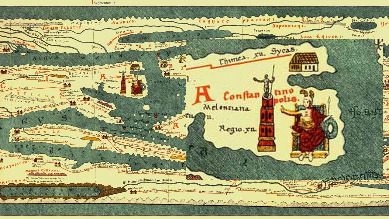
Eάλω η Πόλις remembers the Fall of Constantinople to the Ottomans on the 29th of May 1453. Tabula Peutingeriana, one of the most important Late Roman Itineraries, presents the city of Constantinople in an interesting way.
Tabula Peutingeriana
Modern English dictionaries define the word Itinerary as “a detailed plan for a journey, especially a list of places to visit.” Did you know that an Itinerarium (plural: Itineraria) was an Ancient Roman road map where cities, villages, Mansiones and Mutationes were listed, with the intervening distances marked?
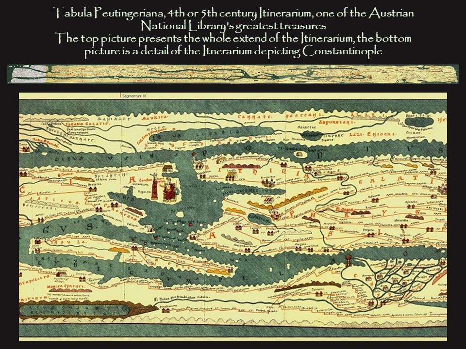
What we know today about Rome’s road system comes from one such Itinerarium, the famous Tabula Peutingeriana, named for its former owner, Conrad Peutinger, a German humanist. Tabula Peutingeriana is a 13th-century copy of an antique world Itinerarium of Roman roads from the British Isles up to India and Central Asia, created sometime around the 4th century A.D. The entire map was originally a long, narrow parchment roll and in its present state measures 6.75 meters long but only 34 centimetres wide. https://www.euratlas.net/cartogra/peutinger/
At first sight, the Tabula Peutingeriana looks very unlike any modern map. It shows the entire Roman world in full colour, including cities, the locations of lighthouses, bridges, inns, tunnels, and most importantly, all the major Roman roads are listed. The distances between various cities and landmarks are marked. But, the landmass and the seas have been stretched and flattened. The Mediterranean has been reduced to a thin strip of water, more like a river than a sea. Instead of being oriented from north to south, the map, which is only 34 cm wide, works from west to east. https://digitalmapsoftheancientworld.com/ancient-maps/tabula-peutingeriana/
The director of the Department of Manuscripts, Autographs and Closed Collections at the Austrian National Library, Andreas Fingernagel, says it is an intensely practical document. “The red lines are the main roads. Every so often there is a little hook along the red lines which represents a rest stop – and the distance between hooks was one day’s travel… Every so often there is a pictogram of a building to show you that there was a hotel or a spa where you could stay, some of the buildings have large courtyards – a sign of more luxurious accommodation,” he said.
For a PowerPoint on Tabula Peutingeriana, please… Click HERE!